And then there was one.
Technically, Tropical Storm Marco still has a fingernail in the northern Gulf, though following the calamitous decoupling of Marco’s low- and mid-level circulations, there is not much left of the little guy other than some rain from Mobile to Panama City.
As of Monday afternoon, Marco’s maximum winds are down to 40 mph. The storm is poised to move inland over far eastern Louisiana, where minimal impacts other than a couple feet of surge are expected as it spins down for the next day.
One of Marco's few notable impacts was heavy rainfall overnight Sunday into Monday morning, particularly along the north Florida coastline. Some sections east of Panama City, including portions of Gulf and Franklin Counties, exceeded 6 inches of rainfall with isolated totals of up to 12 inches. Marco's rainfall totals were more broadly in the 1-2 inches range between Pensacola and Cedar Key and inland.
But for most of the U.S. Gulf Coast, there is a single storm that matters today: Laura.
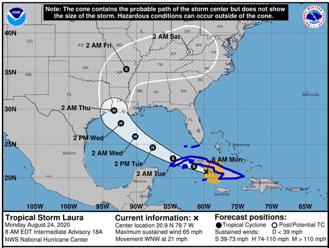
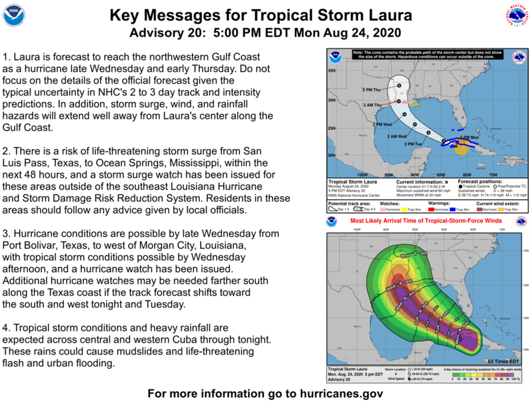
As of the Monday 5 p.m. advisory from the NHC, Tropical Storm Laura is located just offshore western Cuba with sustained winds of 60 mph. Laura moved over the mountains of eastern Cuba in the last day, which broadened its circulation and has kept intensity in check. However, deep convection is re-developing near the center, and strengthening is likely to begin on Tuesday as Laura continues moving west-northwest at 15 to 20 mph into the southern Gulf of Mexico.
The track forecast for Laura is coming into better focus. For the next 36 hours or so, the storm will move west-northwest into the central Gulf, steered by a strong ridge of high pressure centered just east of Florida. Laura will turn north on Wednesday as it reaches the western extent of the ridge and is influenced by an upper-level low over central Texas. On this path, the hurricane will cross the eastern Texas or western Louisiana coastline late Wednesday or early Thursday.
Model guidance favoring this general track has tightened up in the past 24 hours, with risks of landfall in the eastern half of Louisiana or southern half of Texas coastline declining. However, some spread in potential track is tied to how quickly Laura strengthens through Wednesday, with the higher intensity scenarios tending to favor a track a little further west. Landfall will probably be between just north of Corpus Christi and central Louisiana south of Lafayette, with the Texas-Louisiana border perhaps the nexus of risk at present.
The timing and persistence of Laura’s expected intensification remains the $64,000 question. As has been the case for many days, the environmental factors that determine whether a hurricane will strength or weaken look supportive for at least steady and perhaps rapid intensification on Tuesday and Wednesday.
Wind shear is expected to remain 15 knots or less through landfall, mid-level moisture supporting strong convection is ample, and SSTs are very warm, generally in the mid-to-upper 80s, on Laura’s forecast track. The only slight drawbacks noted are that Laura may pass close to a cold-core ring of lower heat potential in the south central Gulf early on Tuesday, and that the forecast outflow pattern on Wednesday doesn’t quite measure up with the environments preceding extremely rapid intensification in the historical record.
On balance this means that strengthening may start a little later Tuesday than the most aggressive models are suggesting, and that the rate of intensification into landfall should hopefully fall short of the theoretical maximum.
Still, there is plenty of upside for maximum winds.
The hurricane-specific suite of models remains quite aggressive with Laura’s intensity through Wednesday night, and more cautious global guidance like the American, European, and British models have come around to suggesting major hurricane strength at landfall. Intensity forecasting, particularly when the potential for rapid strengthening is involved, has high errors, but at this point look for the landfall of a Category 2 to Category 4 hurricane in Texas or Louisiana.
There will be more time to drill down into impacts as the storm approaches, but Laura will likely bring a small region of highly destructive winds somewhere along the west-central Gulf Coast, embedded within a much larger region of potentially damaging winds. While Laura is unlikely to be an extremely large storm, any major hurricane is also capable of delivering 10 to 12 feet or more of life-threatening surge to a broad section of the Gulf Coast along and right of the track.
Laura is likely to keep moving north at a decent clip once inland, so a Harvey-style catastrophic flooding event is not expected. Ike in 2008 provides a reasonable starting point for the possible scope of impacts, though not necessarily their precise locations.
Overall, there have not been too many surprises from Laura in the past 24 hours, but the lack of major changes to the outlook continues to mean strong potential for a major hurricane to impact a section of the west-central Gulf Coast including the Houston metro area and the western half of Louisiana within 60 hours. Preparations for a hard hit should be well underway in Texas and Louisiana. Keep watching the skies.

Dr. Ryan Truchelut is chief meteorologist at WeatherTiger, a Tallahassee start-up providing advanced weather and climate analytics, forensic meteorology and expert witness consulting, and agricultural and hurricane forecasting subscription services. For more information, visit us at weathertiger.com or get in touch at ryan@weathertiger.com.
tinyurlis.gdu.nuclck.ruulvis.netshrtco.de
مقالات مشابه
- آنچه ما در مورد قیمت دستگاه تصفیه آب به شما بیاموزد
- 8 از جنجالیترین طراحی داخلی جناسها پیدا خواهید کرد
- شرکت صادرات و واردات کالاهای مختلف از جمله کاشی و سرامیک و ارائه دهنده خدمات ترانزیت و بارگیری دریایی و ریلی و ترخیص کالا برای کشورهای مختلف از جمله روسیه و کشورهای حوزه cis و سایر نقاط جهان - بازرگانی علی قانعی
- کرم آبرسان قوی لدورا 120 میلی لیتر - بازاریابی شبکه ای پنبه ریز
- شرکت صادرات و واردات کالاهای مختلف از جمله کاشی و سرامیک و ارائه دهنده خدمات ترانزیت و بارگیری دریایی و ریلی و ترخیص کالا برای کشورهای مختلف از جمله روسیه و کشورهای حوزه cis و سایر نقاط جهان - بازرگانی علی قانعی
- The Place اسباب بازی یکی از بهترین است؟
- Hurricane Sally: Power to be restored to all of Santa Rosa by midnight Sunday
- شرکت صادرات و واردات کالاهای مختلف از جمله کاشی و سرامیک و ارائه دهنده خدمات ترانزیت و بارگیری دریایی و ریلی و ترخیص کالا برای کشورهای مختلف از جمله روسیه و کشورهای حوزه cis و سایر نقاط جهان - بازرگانی علی قانعی
- UCLA در اخبار اوت 6, 2020
- شرکت صادرات و واردات کالاهای مختلف از جمله کاشی و سرامیک و ارائه دهنده خدمات ترانزیت و بارگیری دریایی و ریلی و ترخیص کالا برای کشورهای مختلف از جمله روسیه و کشورهای حوزه cis و سایر نقاط جهان - بازرگانی علی قانعی