
Old Maps – The Changing Village through the Ages

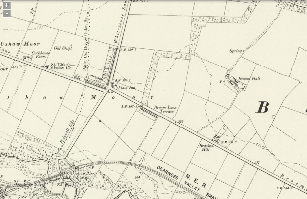
Surveyed_1857_Published_1861
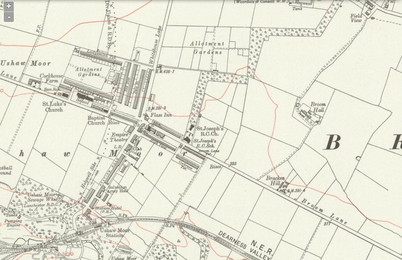
Revised_1895_Published_1898
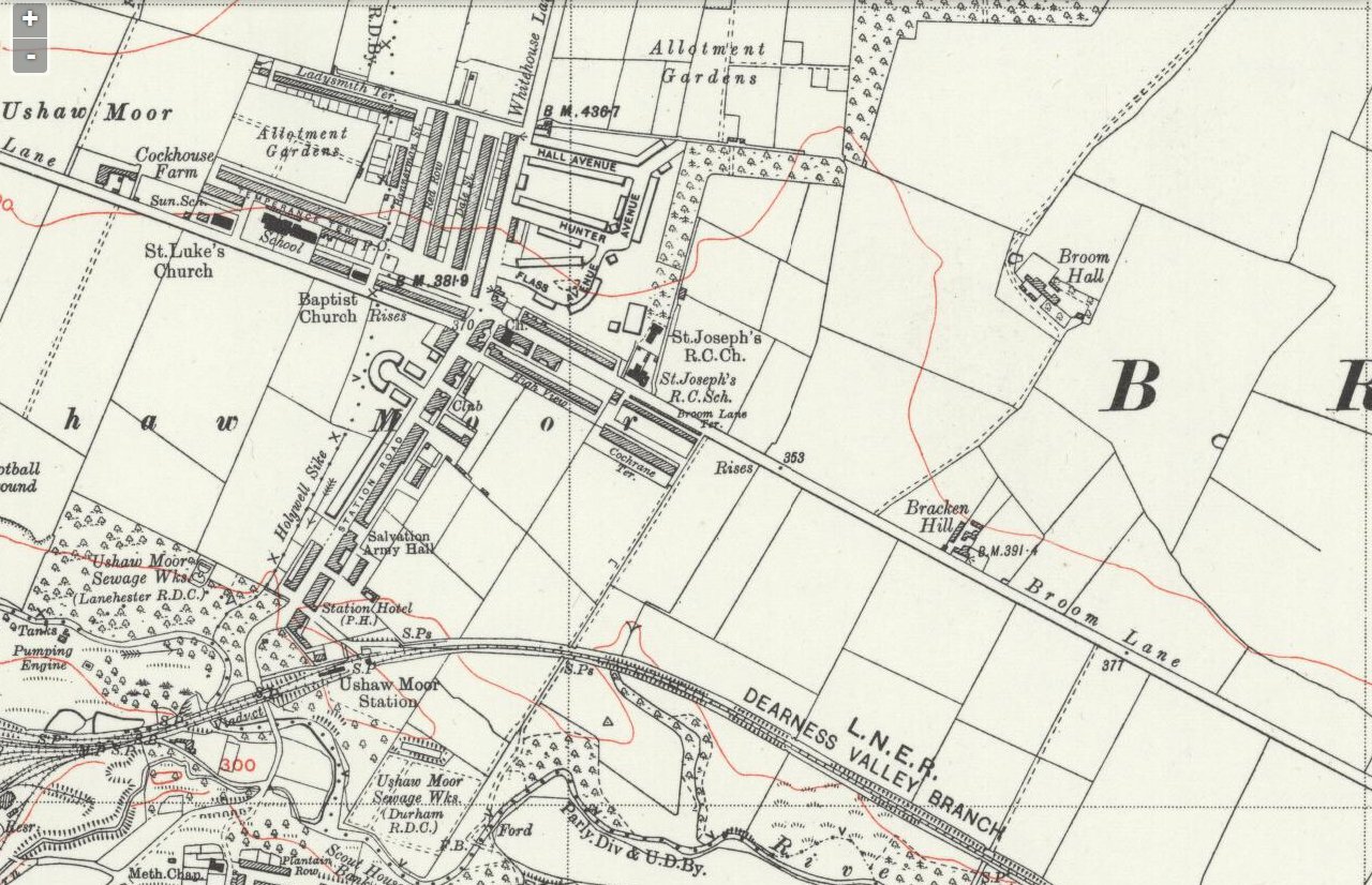
Revised_1915_Published_1923
Revised_1939_Published_1947
Leave a comment
Ushaw Moor Historical Website


 Ushaw Moor VIDS
- An error has occurred; the feed is probably down. Try again later.
British Pathe – Durham Vids


The maps prove that like many other Durham villages, Ushaw Moor owes its existence to the coming of the colliery which opened in 1865
Very Interesting Paul. I notice Dearness is that a mistake for Deerness (maybe).
Seems originally Dearness then more recently, Deerness. Same for Breckon Hill, named after farm Bracken ?
Ido not understand Red Row where Ushaw Terrace should be
I always knew it as Dearness. It would appear that the North Eastern Railway mis-spelt it as Deerness when they opened the Durham to Bishop Auckland line with Deerness Valley Junction in 1857
I wonder what happened to Bracken Hill? I would guess that is pretty much where the Sports Centre is now. Just next to the sports centre are 3 or 4 private bungalow style houses which are now surrounded by oakridge road. Maybe they show where it used to be. Was it a little hamlet or just a farm ?
Just realised that it is still referred to as Breckon Hill, and heres one of the homes for sale. Wonder if it was originally a farm sold into 3 or 4 lots. http://www.rightmove.co.uk/property-for-sale/property-31941920.html